Your Ultimate Guide to the Virginia Creeper Trail
The Virginia Creeper Trail is one of our country’s best rails to trails. A rail trail is a recreational path created by repurposing abandoned railroad tracks. I biked the VCT twice this fall and learned different things on each trip.
How to Get There
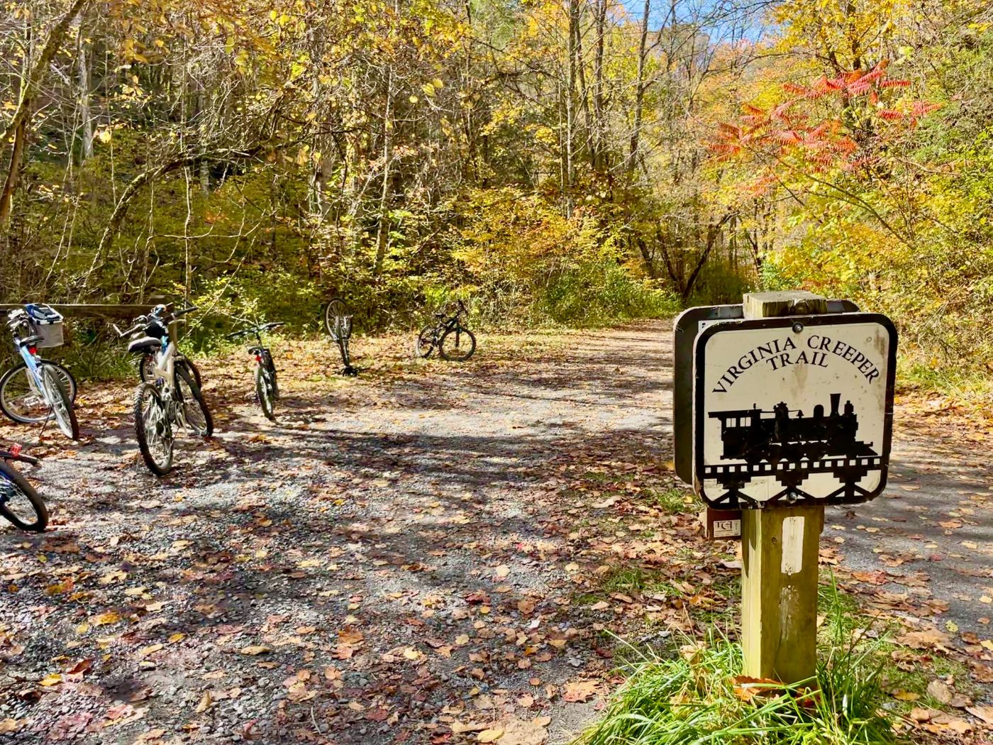
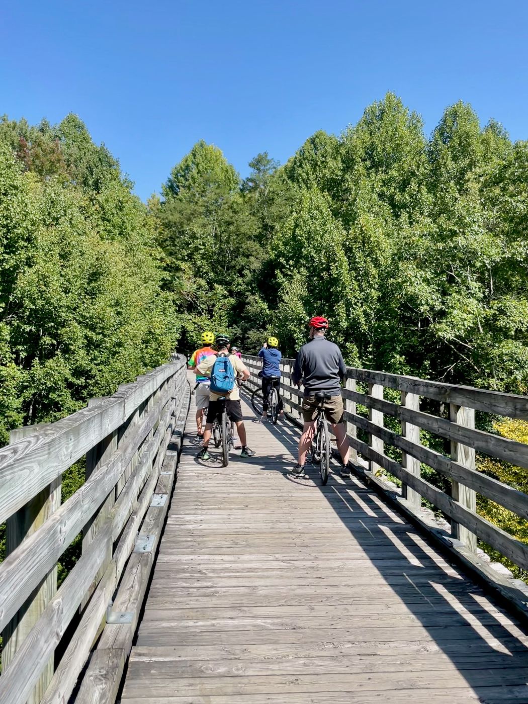
The VCT is in the scenic southwestern corner of Virginia. It begins in Abingdon and ends at White Top Station very close to the North Carolina border. The full trail includes thirty-four miles of hard packed ground and forty-seven wooden trestle bridges. Most cyclists do the trail in reverse taking a rental bike shuttle to White Top and coasting down 17 miles to Damascus. This is the section my husband and me rode.
We were attending an Abingdon destination wedding and the couple’s website recommended it as a fun thing to do. The Virginia Creeper Trail Bike Shop provided our bicycles and transport from Abingdon. They picked us up in Damascus 4 hours later for the return to Abingdon. The second time we went was a day trip from visiting Boone, NC. We drove to Damascus and rented bike and shuttle service from another outfitter (with a similar name), The Creeper Trail Bike Rental.
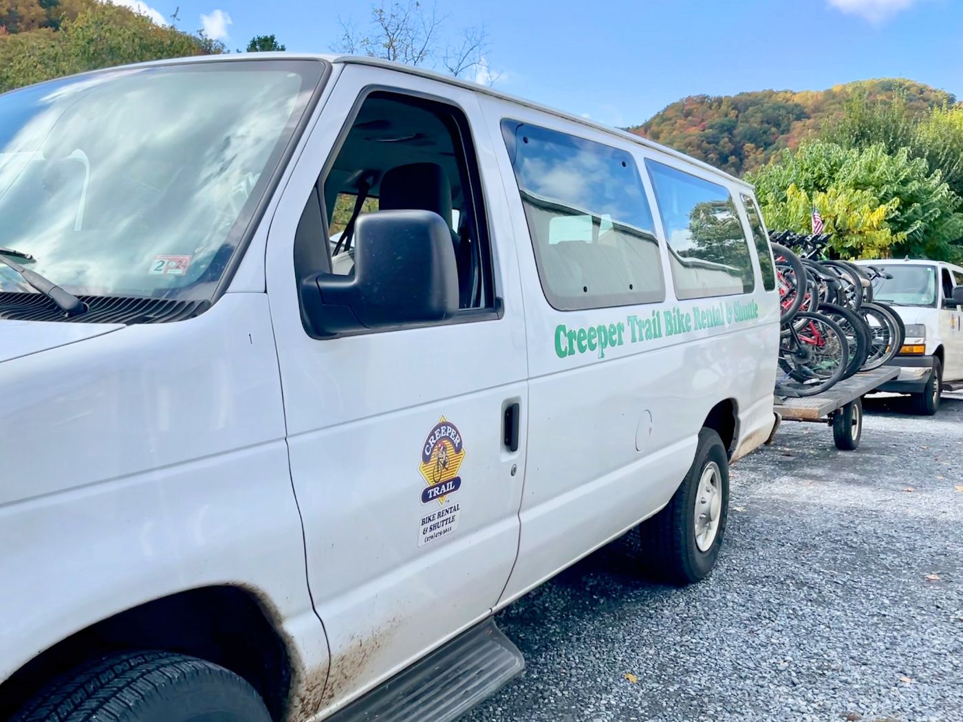
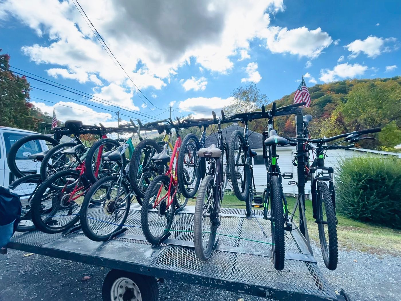
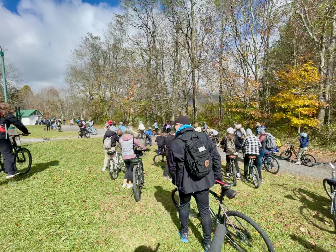
Currently there are eight bike and shuttle rental services available. You need to book early. They stagger drop-offs and limit the number of cyclists so the trail doesn’t become over crowded. The drive to White Top is a dizzying mountain climb filled with hairpin turns and I was glad we left the driving to professionals!
Trail History
Originally the railroad ran over 100 miles from Abingdon, Virginia to West Jefferson, North Carolina. In the 1890s it carried coal, in later years, timber, mail and tourists. It earned its nickname, the Virginia Creeper, from the slow speed with which it crept up the mountain. It’s a clever double entendre; there is a common vine that grows in the area called Virginia Creeper. The train took its last trip in 1977. The rise of Interstate trucking drove many railroads out of business. N&W sold the tracks and ties. The trestles were next to be dismantled for salvage.
Fortunately, Abingdon visionaries Dr. French Moore and Dr. Dave Brillhart stepped in. They had been inspired by rails to trails already completed in the country. They succeeded, and the rail trail opened in 1987. For an in-depth look at the dramatic obstacles overcome to create the trail check out this VCT WEBSITE, in particular the entertaining 2009 interview with Dr. French.
Biking White Top to Damascus, Start of the Trail
My first trip to the VCT was a Friday in late September. The shuttle ride from Abingdon took over an hour. Leaving the shuttle, I felt a significant temperature drop from Abingdon to White Top. I also noticed there is no cell service. The station is located in the Mount Rogers National Recreation Area. White Top Mountain is the second tallest Mountain in Virginia. Nearby Mount Rogers is the highest. The White Top Station Visitor Center is a replica of the original depot and is open seasonally. Inside is a historical display of railroad and Appalachia history. The trail start wasn’t crowded at all. Take your opportunity to visit the flushable toilets there.
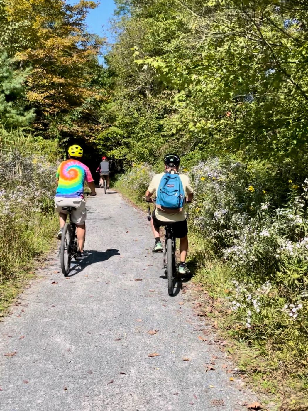
Fast forward to a Saturday in late October – White Top was packed! In addition to the crowd, recent rain had changed the trail condition from a mostly level, dry, packed surface to areas of muddy ruts, and slippery leaves. Peak autumn colors had arrived though, and as long as you were watchful, the trail was doable.
Recommended Photo Stop 1, the Farm Vista
Shortly after I began the trail, I noticed a group of parked bikes. Curious, I left my bike and walked the short, wooded path. A gorgeous expanse of farmland with a pumpkin patch was my reward. It’s one of the best places on the trail for selfies. You have to be mindful of where you stop, especially when the trail is crowded! Abrupt, unexpected stops by bikers are a leading cause of mishaps on the VCT. The trail is marked, ‘no bikes.’ Please be respectful, if you check out the spot, so it will continue to be available to future riders. The Virginia Creeper Trail is bordered by private property in many areas.
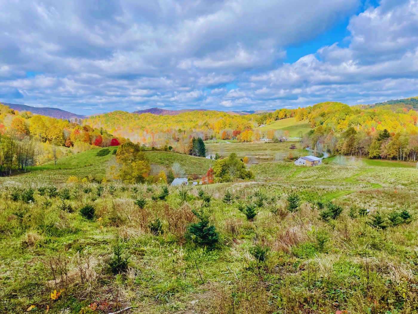
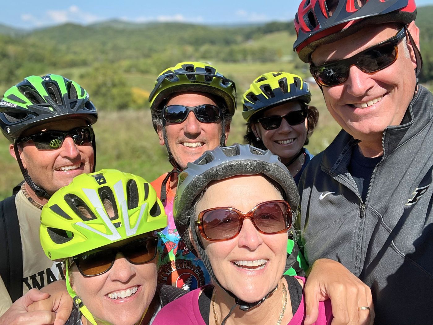
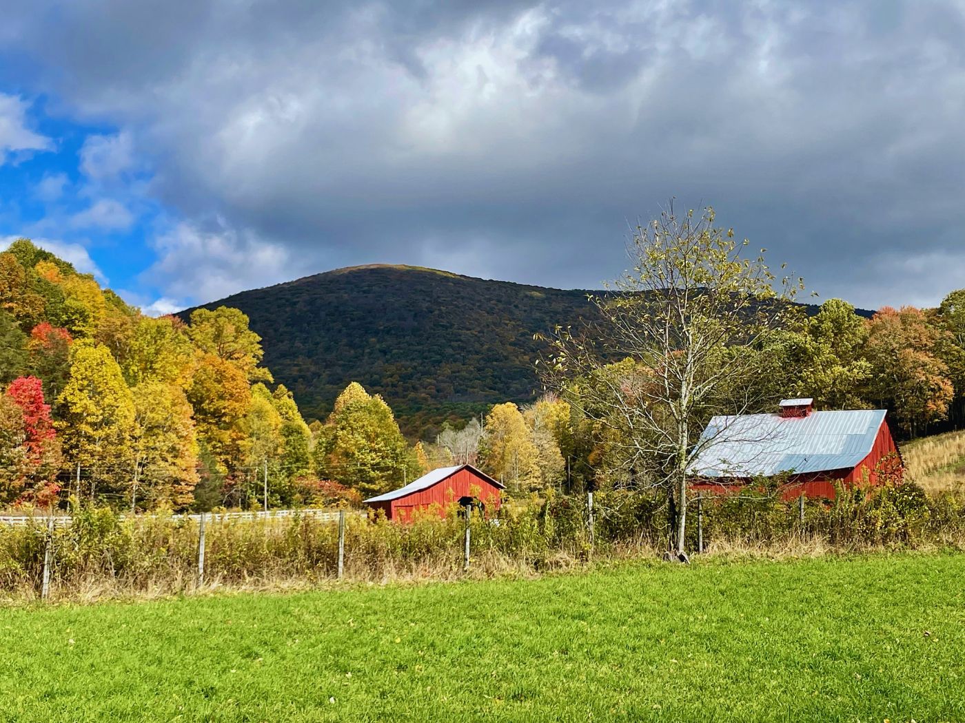
Photo Stop 2, the Red Barns
Right after the farmland, two classic red barns come into view. I’m a photo-hobbiest and can’t resist picturesque barns.
Biking White Top to Damascus, Mid-Trail
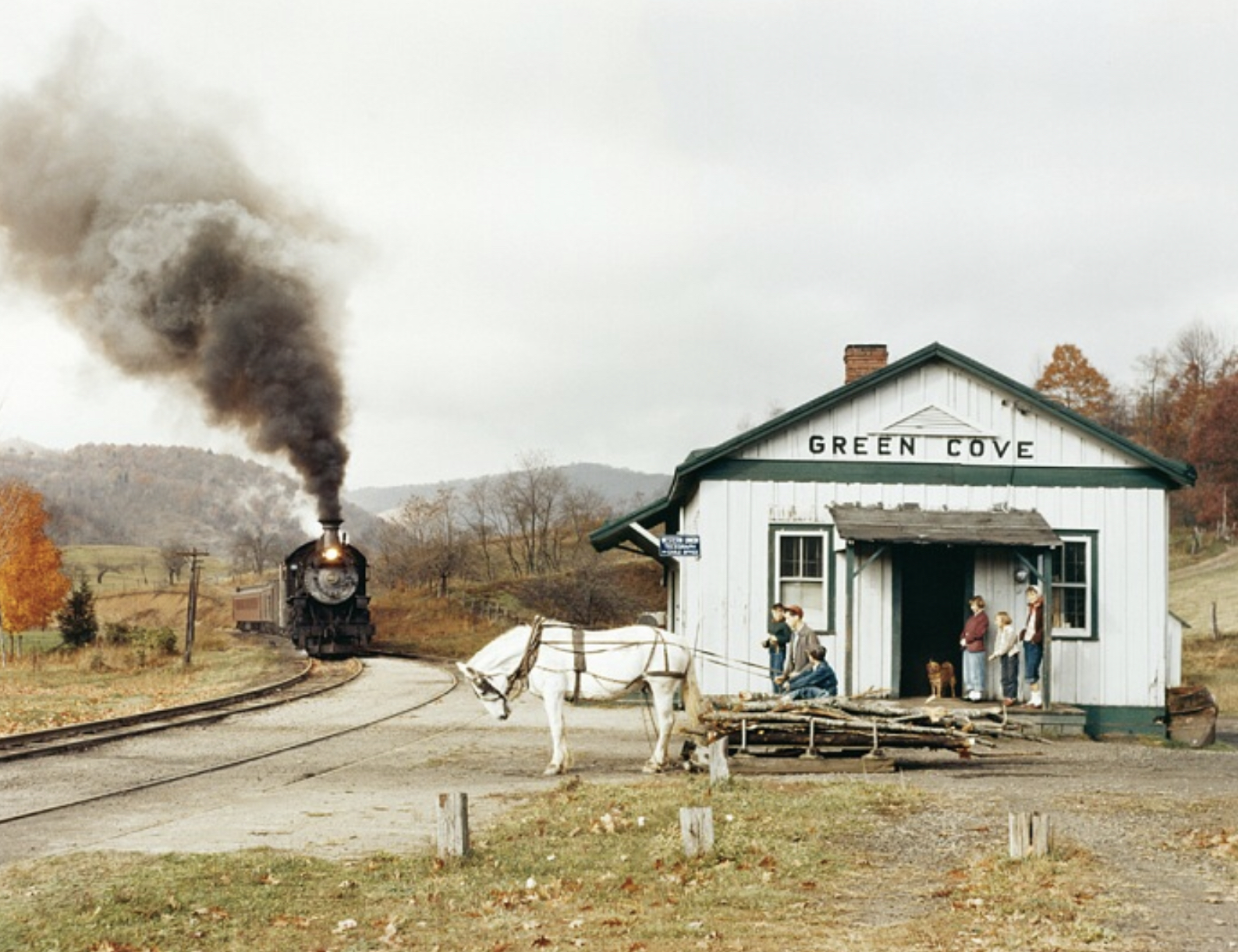
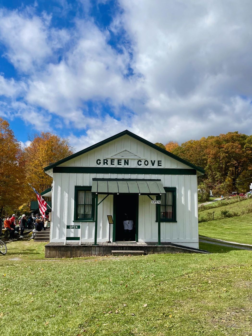
We were all ready for a quick bathroom stop when we arrived at the Green Cove Depot. This is the original station which served as a general store and post office for the area. The interior is an authentic step back in time. It’s charming and worth hopping off your bike for a quick look. There are portable potties located here. Take advantage. Sometimes, miles go by without access to bathrooms.
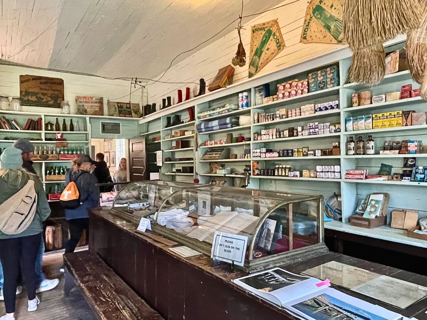
Photo Stop 3, Green Cove Station
The Green Cove Station is where extraordinary steam engine photographer, O. Winston Link, took his picture of Maud and the Virginia Creeper Steam Engine. There is an outdoor plaque in front of Green Cove displaying this iconic shot. Of course, I needed a photo of this place!
Twenty minutes or so past Green Cove we stopped and enjoyed some time on the Laurel Creek Boulders. It’s a good place for a packed snack and drink.
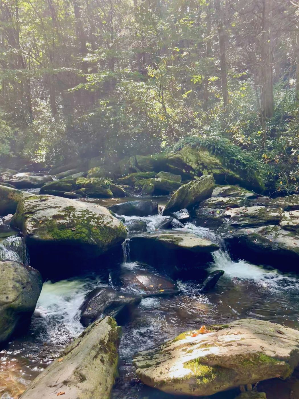
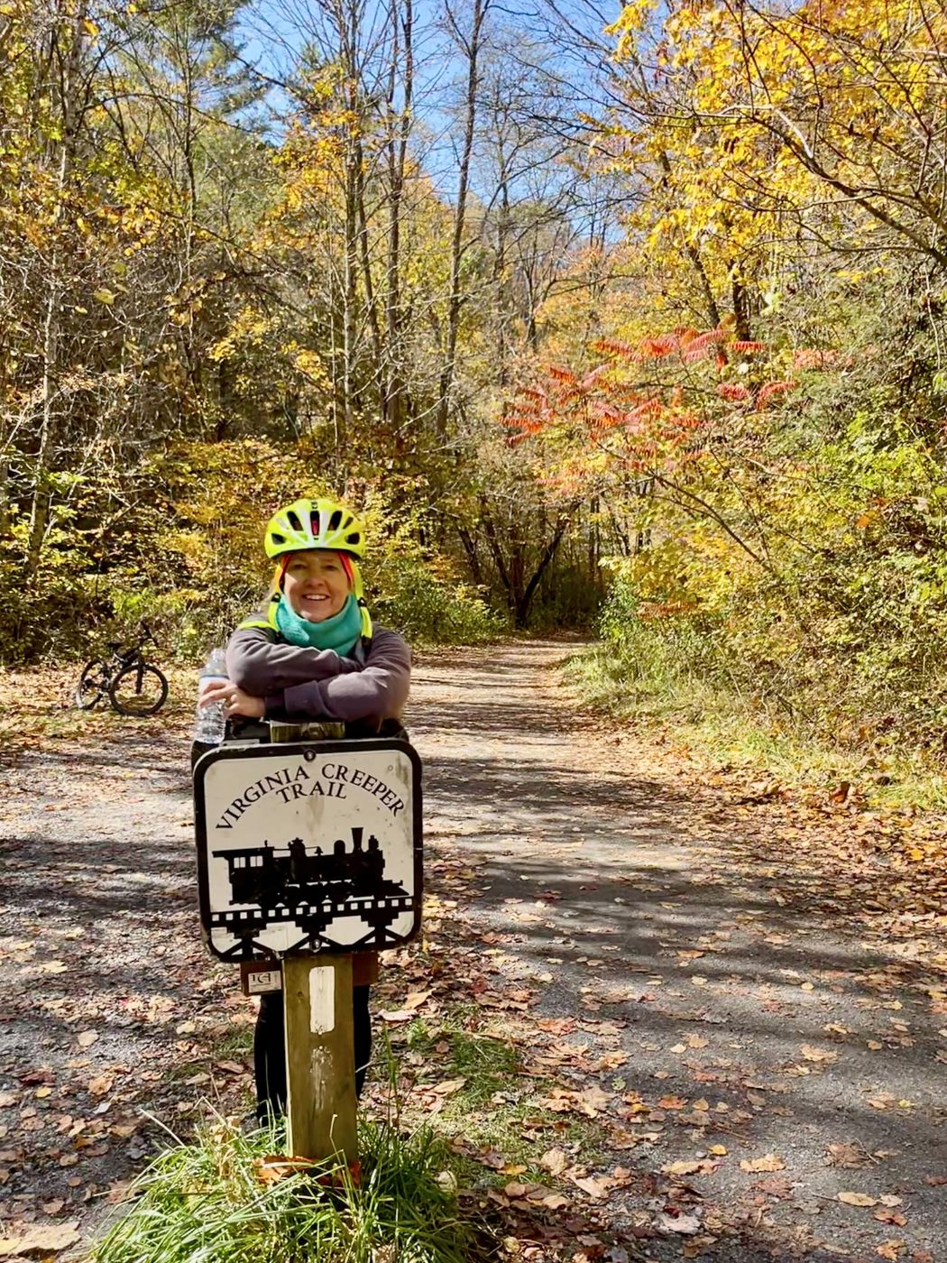
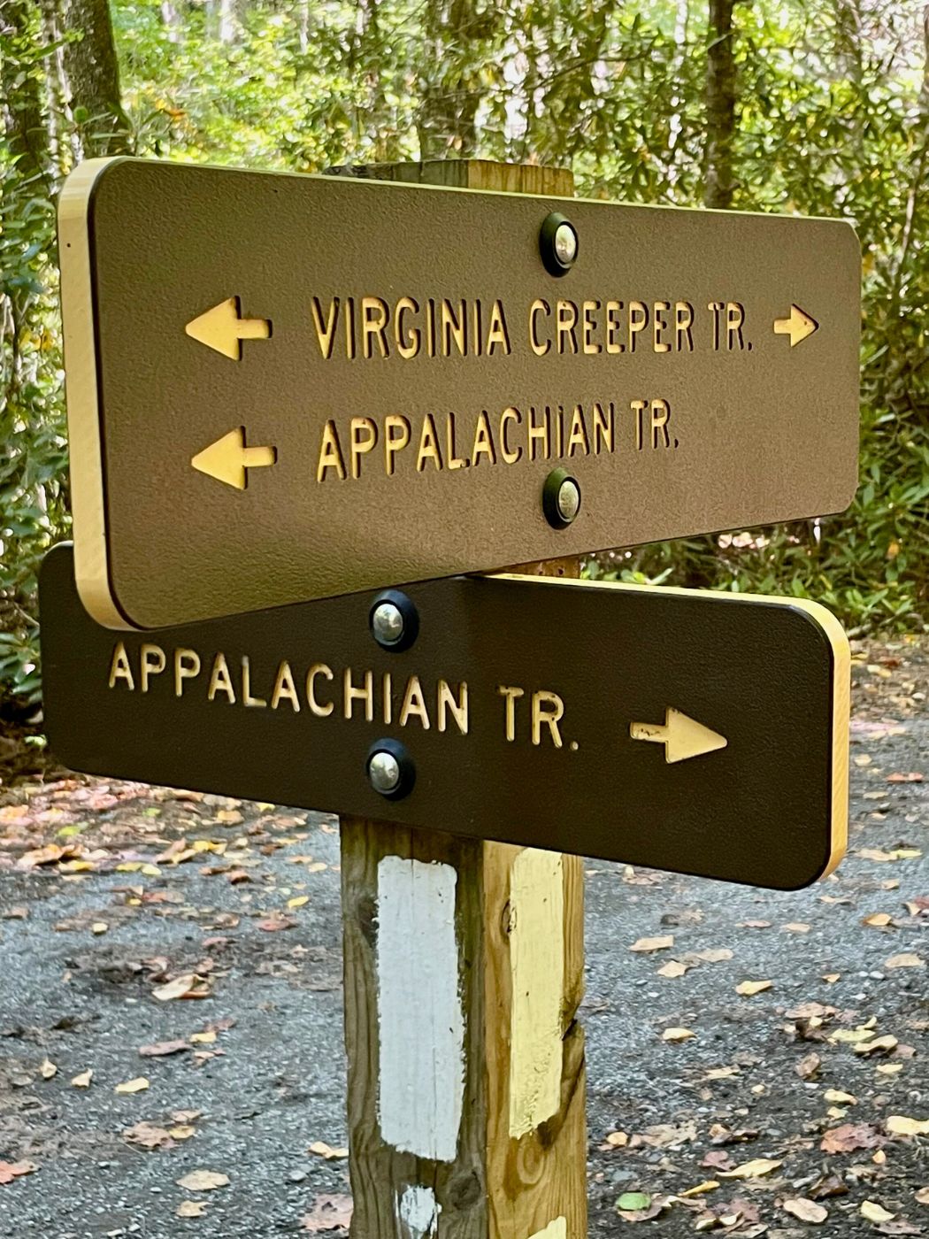
Photo Stop 4, Train Trestle Sign
Another good place to commemorate your trip with a picture is the train trestle sign. It’s a nice, wide and safe place to stop. Just beyond it is the Appalachian Trail/Virginia Creeper Trail Marker.
Biking White Top to Damascus, the Lower Trail
There’s a restaurant on this section of the trail. Hellbender’s Cafe was closed when we rode through on Friday, September 25. It was open for our next ride on Saturday, October 21. I thought it was named for the twists and turns on the trail, but it’s actually for a large, creepy salamander. There are flushable toilets there, the lines were long. However, while I was waiting, a beautiful deer ran by!
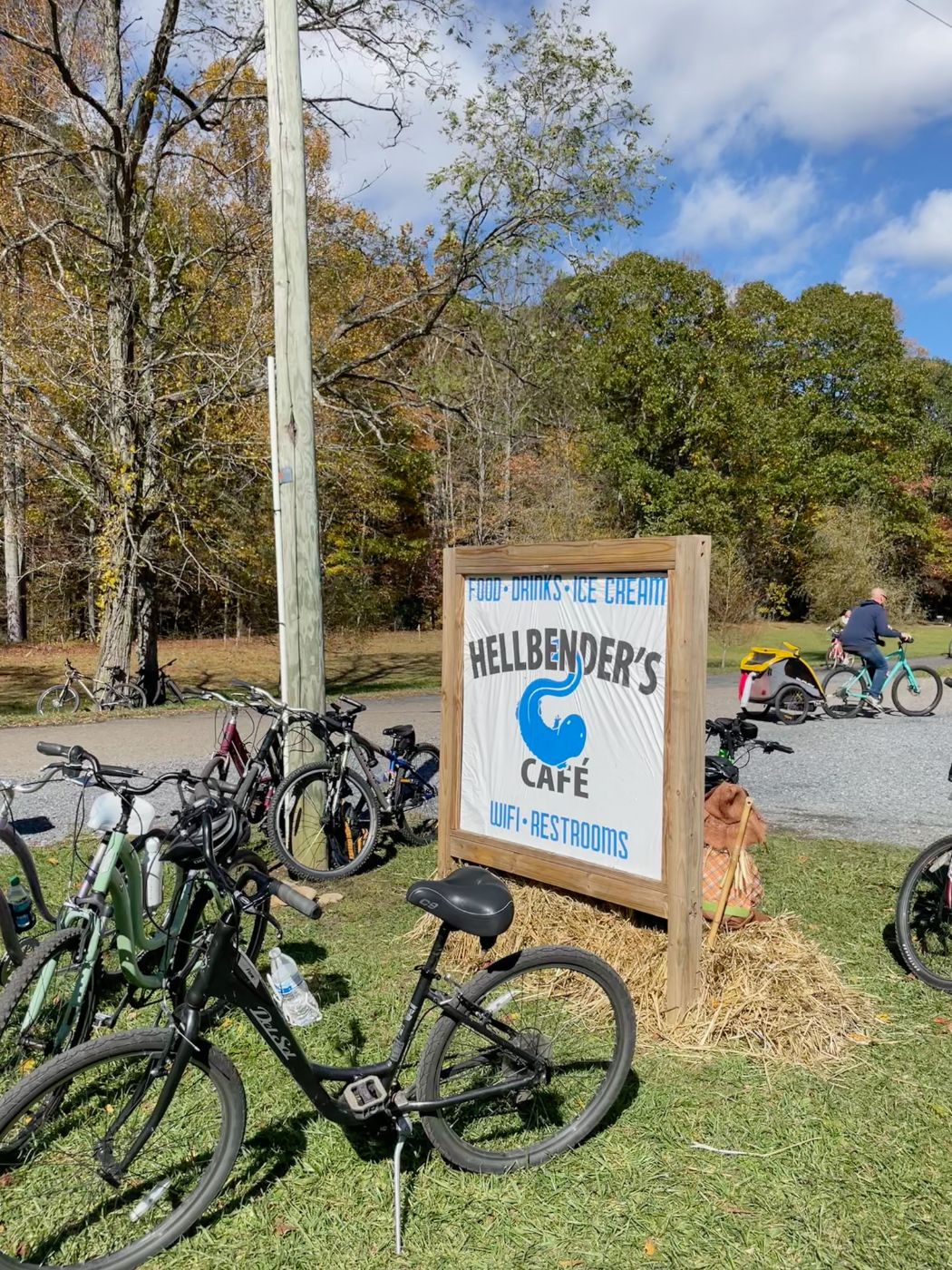
Photo Stop 5, Train Trestle 18
My favorite trestle is #18. It is one of the last ones before Damascus. The steel top makes it unique compared to the others we crossed. If you want to get an insta-worthy shot make sure to pull safely over out of traffic’s way!
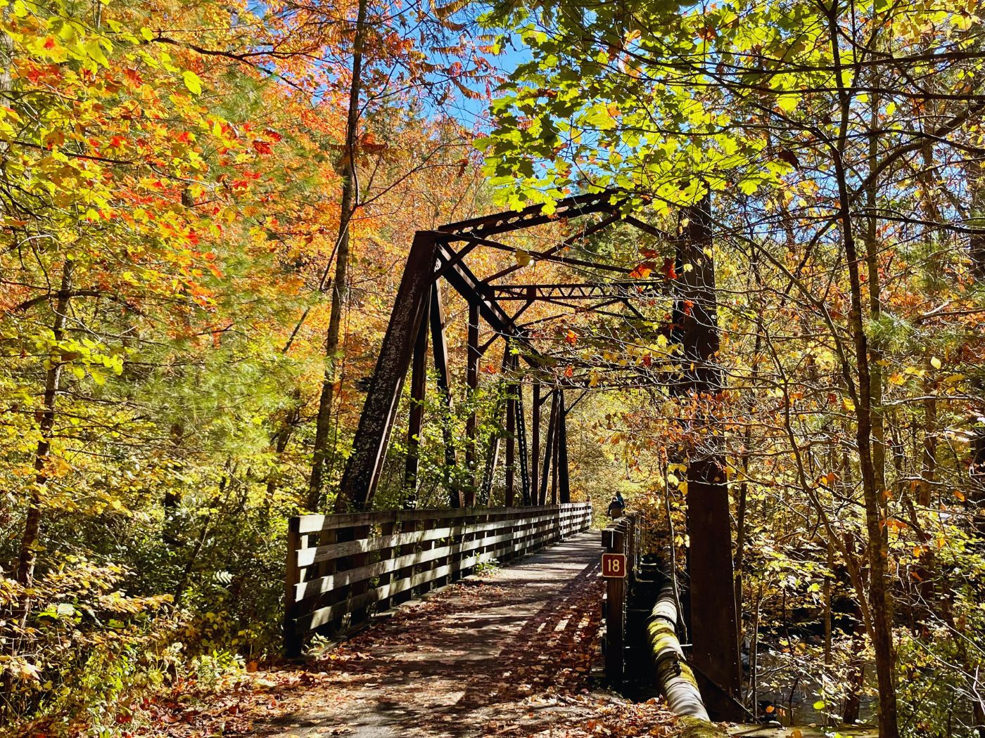
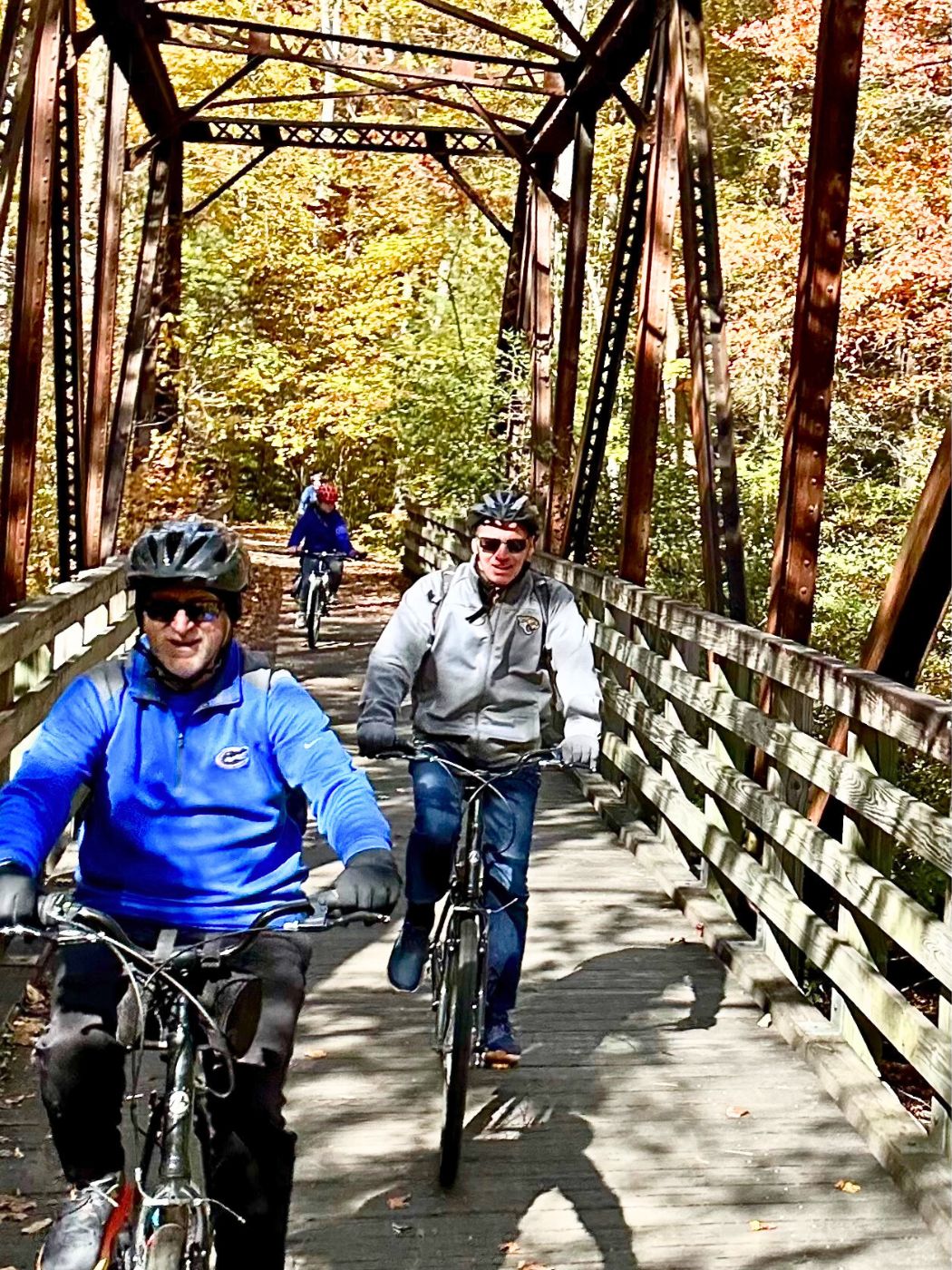
Photo Stop 6, Sasquatch
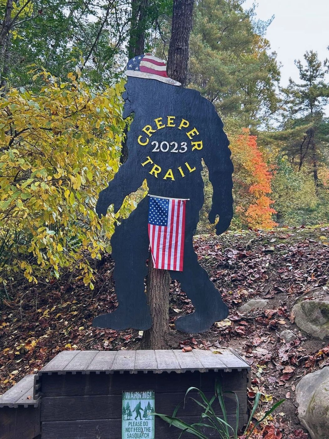
Record a good trail memory by getting your picture with Big Foot!
The Trail’s End, Charming Damascus
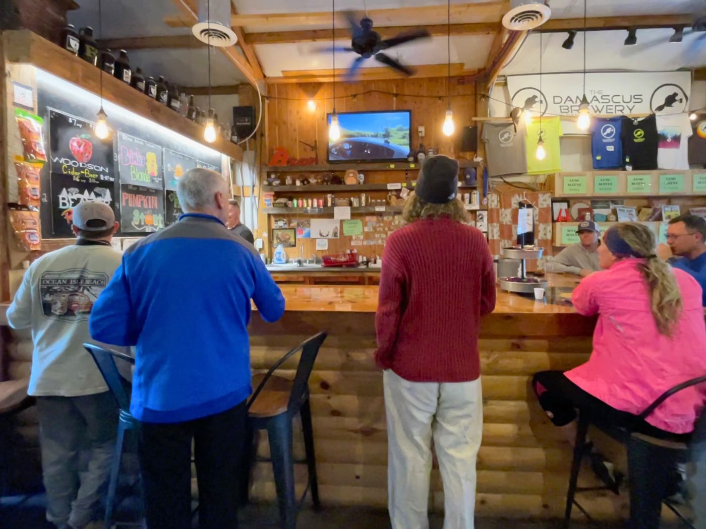
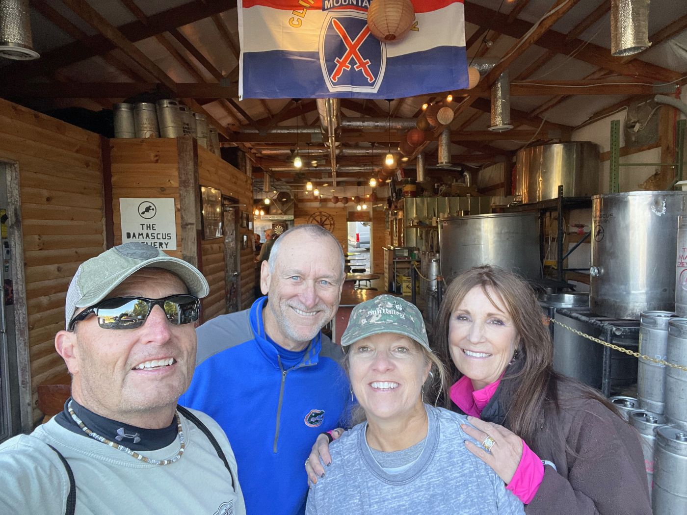
Damascus has a population of about 900. It serves as the hub for the Virginia Creeper Trail and offers many lodging and dining options. Our September ride took us 4+ hours. The trail was so peaceful and open we stopped multiple times to take it all in. The ride in October provided prettier foliage, but more crowds. It was trickier to stop. It took our group 3 hours to finish. We had more time before our bikes’ were due, so we enjoyed beers at the Damascus Brewery.
Trail Safety
We came upon a rider accident during our September trip. An ATV/4-wheeler had already arrived along with local paramedics to help the injured cyclist. With limited cell service on the trail part of her party had to ride ahead to get help. The trail is not difficult, but you need to be mindful of the following: transitions on and off the trestles, roots, muddy ruts on the path form with rain, people may stop unexpectedly before or on the narrow bridges, faulty chains or brakes. The rule of the trail is to yell out, “on your left,” when passing slower riders. Most bike traffic coasts down the 1600 foot elevation drop, but there are cyclists that ride up from Damascus to White Top. They have the right of way. Make a meet up plan in the event you get separated from your group.
What to Bring
Wear sensible biking/exercise clothing, fitted pants, or leggings in colder weather that wont get caught in the bike chain. A small back-pack is good for carrying a snack and water, as well as extra layers you might shed when you warm up as you go. Sunglasses and sunscreen. We brought a small wireless speaker. On the crowded ride, we didn’t listen to music much, but on the more easy-going September ride, we did.
Both trips were great, but I preferred the more low-key September weekday ride. However, my photos were better from the October visit. Have you done the trail? Please leave a comment to help others, if you have other photo spot recommendations or advice!
Video from Our September Ride
Biking the Trail from Abingdon to Alvarado Station
Are you now curious about the other half of the trail? Check out this blog post from Get Lost in the USA.
When to Visit and Other Details
The VCT is open all year, but some amenities along the trail are only open seasonally. CLICK HERE to see the Virginia Creeper Trail’s excellent website.
Is there a rail trail near you? CLICK HERE to explore the Rails to Trails Conservancy website.
Just want to mention that the station at Green Cove is the original station not a replica and the store set up is original also. The station at Whitetop is a replica, built after the trail became popular. Glad you enjoyed the trail!
Wow! Thank you for letting me know Green Cove is the real-deal. I love history and authenticity. I will edit the post to reflect that.